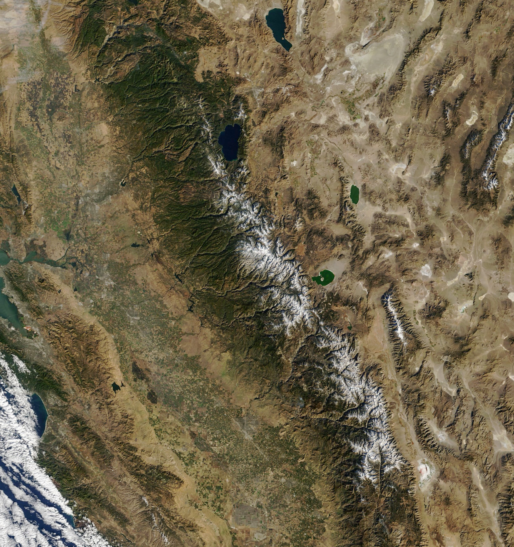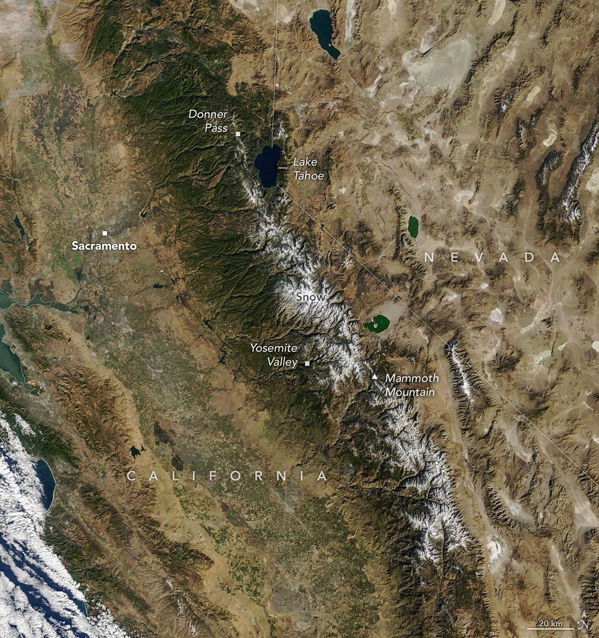


November 12
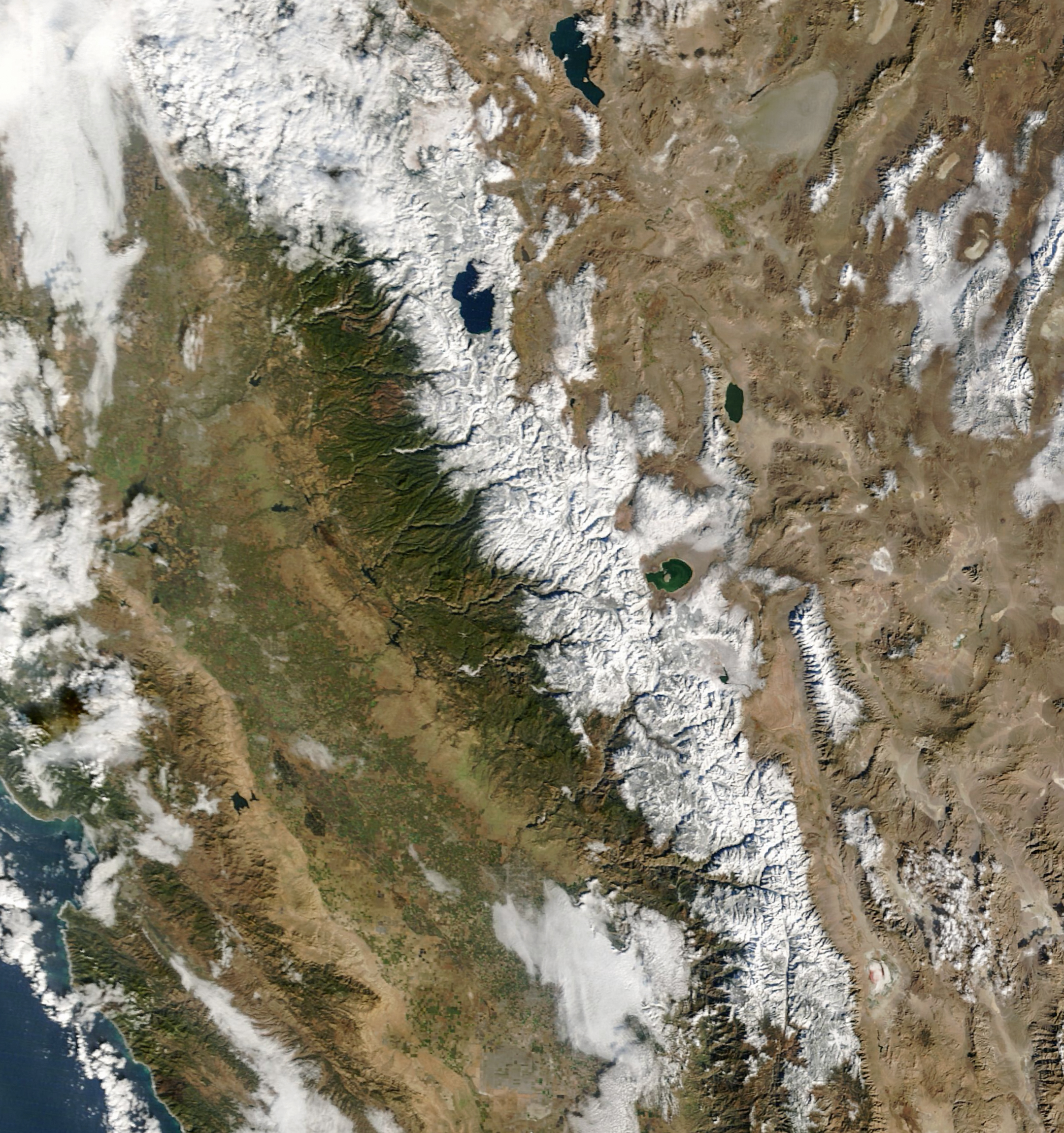
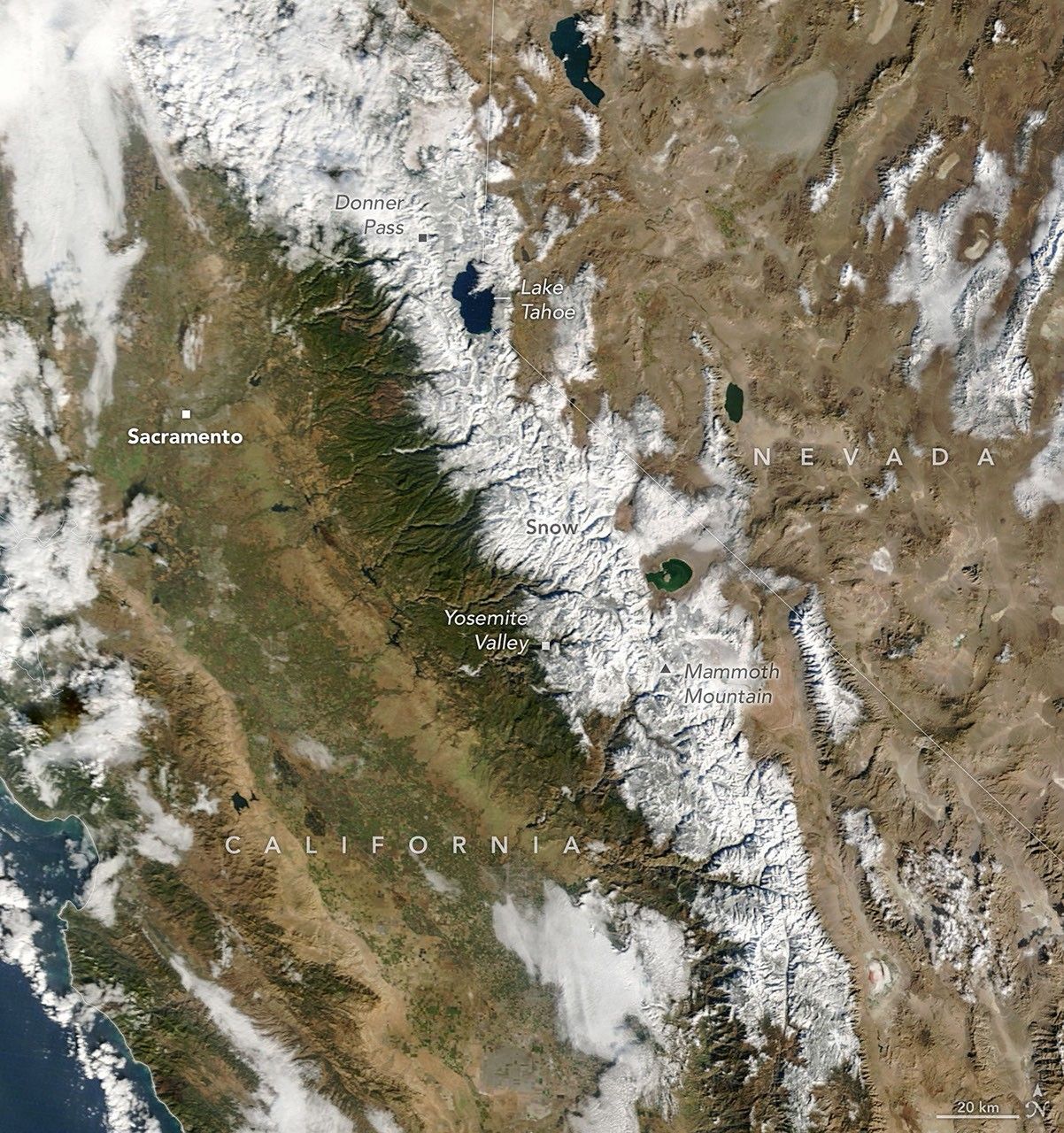
November 14
California’s Sierra Nevada got an early taste of wintry weather when one of the first major snowfalls of the water year arrived on November 13, 2026. A moisture-laden storm delivered heavy rains to lower elevations in the Sacramento area and snow accumulations of around a foot to some mountainous areas. The recent bout of wet weather was the first in a quick succession of Pacific storms bringing rain, snow, and wind to the U.S. West in mid-November.
The MODIS (Moderate Resolution Imaging Spectroradiometer) on NASA’s Terra satellite captured this image (right) of fresh snow in the Sierra Nevada on the morning of November 14, during a lull between weather systems. Two days earlier (left), the mountains were mostly bare, with snow appearing only at the highest elevations.
Nearly 12 inches (30 centimeters) of snow fell at Donner Pass, northwest of Lake Tahoe, on November 13, according to the Central Sierra Snow Laboratory. The accumulation snarled traffic on Interstate 80 in the area, prompting officials to close the highway in both directions that evening. To the south, the ski resort at Mammoth Mountain reported 9 to 13 inches (23 to 33 centimeters) of new snow, and officials at Yosemite National Park closed several roads ahead of the storm.
More wet weather and mountain snow are forecast to follow. The National Weather Service (NWS) issued a winter storm warning for portions of the Sierras above 5,000 feet (1,500 meters) in elevation from November 18 to 20. NWS warned of difficult-to-impossible travel conditions, gusty winds, and snow accumulations of around 4 feet (120 centimeters) possible above 8,000 feet (2,400 meters).
NASA Earth Observatory images by Michala Garrison, using MODIS data from NASA EOSDIS LANCE and GIBS/Worldview. Story by Lindsey Doermann.


References & Resources
- Active NorCal (2026, November 14) First Major Sierra Storm Shuts I-80 Over Donner Summit and Buries Carson Pass in a Foot of Snow. Accessed November 17, 2026.
- CapRadio (2026, November 13) First major rain and snowstorms of the season hit Northern California. Accessed November 17, 2026.
- The Weather Channel (2026, November 17) West storms to bring feet of mountain snow, flooding in California. Accessed November 17, 2026.
- Weather West (2026, November 11) Sudden shift to active, stormy pattern in California during second half of November. Accessed November 17, 2026.
You may also be interested in:
Stay up-to-date with the latest content from NASA as we explore the universe and discover more about our home planet.

Back-to-back winter storms in August 2026 brought snowfall to northern Chile, from the Andes to near the Pacific coast.
Rounds of heavy rain in the U.S. Southwest flooded rivers and rapidly raised New Mexico’s second-largest reservoir.
The powerful low-pressure system formed over the North Atlantic out of the remnants of Hurricane Isaias.