
Tropical Cyclone Alfred is expected to make landfall this week, with authorities warning it could impact heavily populated areas across hundreds of kilometres of coastline.
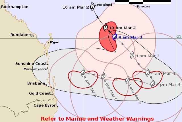
The Bureau of Meteorology is warning the category two system could cross the coast between Bundaberg and northern NSW on Thursday.
The cyclone is currently about 465 kilometres north-east of Brisbane and tracking south-east at 13 kilometres per hour.
It is forecast to continue moving south-east on Monday, before turning west and tracking back towards the southern Queensland coast on Tuesday.
Premier David Crisafulli said the system could impact a “large geographical area”, bringing severe wind warnings, erosion and flooding right across the region.
“We’re talking about an area everywhere from Bundaberg to south of the border,”
he said.
The last tropical cyclone to cross the coast in south-east Queensland was ex-Tropical Cyclone Zoe in 1974.
The cyclone is expected to impact rail services on the coast between Brisbane and Gladstone.